Cycling · 5 July 2014
Cycling the Ridgeway Trail, Oxfordshire, Berkshire, Wiltshire
The Ridgeway National Trail runs for 87 miles across south-central England, from Overton Hill near Avebury in Wiltshire to Ivinghoe Beacon near Tring in Buckinghamshire. It is an off-road route for most of its length, cr
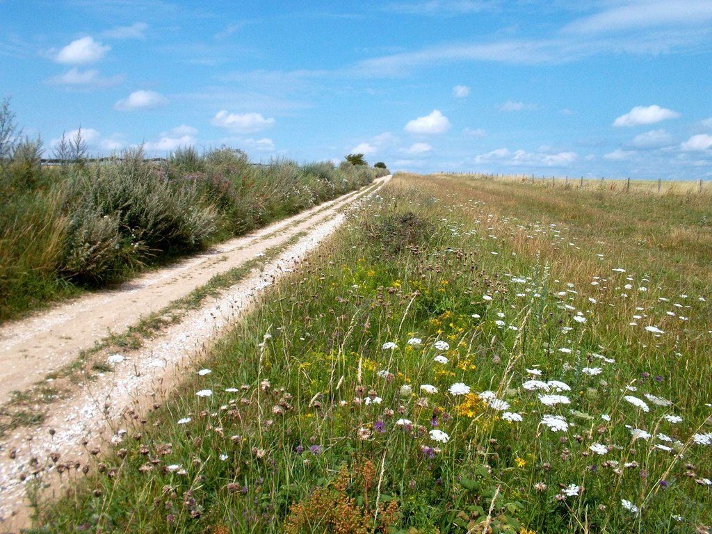
The Ridgeway National Trail runs for 87 miles across south-central England, from Overton Hill near Avebury in Wiltshire to Ivinghoe Beacon near Tring in Buckinghamshire. It is an off-road route for most of its length, crossing chalk downland, grassy bridleways, fields and tracks, and it calls for a mountain bike rather than a road bike.
A group of friends who take a couple of cycling weekends away each year tackled the trail again, having first ridden it some years earlier. This time they chose a different base and rode in opposite directions on each of their two days.
Know before you go
- Distance: 87 miles on the official route.
- Start: Overton Hill, near Avebury, Wiltshire.
- Finish: Ivinghoe Beacon, near Tring, Buckinghamshire.
- Surface: mainly off-road, with chalk downland, bridleways, fields and tracks.
- Bike: a mountain bike is required.
Navigation is straightforward with a GPS device, and a waterproof trail map covering the whole route is worth carrying alongside the relevant Ordnance Survey Landranger sheets. Sheets 173, 174, 175 and 165 cover the trail, although 173 takes in only a short stretch at the western end.
A base halfway along
The group stayed at a pub in East Ilsley, a small village roughly midway along the trail and 37 miles from Overton Hill. It proved a good choice: friendly owners, decent breakfasts and dinners, a couple of well-kept ales, and a lockable garage beside the car park for storing bikes overnight.
The Ridgeway itself is about a mile from the village, reached by a grassy, overgrown bridleway. Without knowing what the surface was like beneath the grass, the group found that first stretch awkward to ride.
Two days on the trail
- Day one: East Ilsley to the western start at Avebury and Overton Hill, returning by the same route. 75 miles, almost entirely off-road.
- Day two: east along the Ridgeway to Watlington, returning by road. 42 miles, a mix of on- and off-road riding.
West to the start
The first day was physically demanding. The distance alone was considerable, and although the terrain was rarely technically difficult, the narrow tracks and overgrown grassy sections demanded constant concentration. Near Avebury progress slowed to a crawl, with the track badly overgrown and deeply rutted.
Because no villages sit directly on this western stretch, the day was fuelled by water, energy gels and cereal bars rather than a proper lunch. Riders who took a shorter outward route had time to detour to a village to eat; there was no such opportunity on the longer leg. A time or mileage limit for the outward ride would be a sensible precaution next time, since 75 off-road miles makes for a long and tiring day even for reasonably fit riders.
East to Watlington
The second day was far more relaxed and a welcome change after the first. The route followed the Ridgeway to Streatley and Goring, where the river setting is lovely, before joining the Swan’s Way to Watlington. A few bumpy field tracks provided the only real challenges, and otherwise the going was much easier than the previous day.
Lunch was taken at a pub in Watlington, where heavy rain set in. The return leg afterwards included an entertaining muddy section, at one point leaving tyres roughly three times their usual diameter with accumulated mud. The rain also meant riding through a ford, which was good fun but left soaking wet feet.
The ride home followed either the same route or country lanes through Streatley to Aldworth, Compton and East Ilsley. Whichever way you go, the stiff climb out of Streatley is the hardest part of the journey back.
What to expect from each half
The western section of the Ridgeway is a mixture of wide and narrow tracks, some climbs, grassy fields and stretches of overgrowth, so there is something to suit most riders.
Much of the eastern end beyond Streatley cannot be cycled, as it is a footpath. From there, riders need to follow the Swan’s Way and other bridleways and country lanes instead.
The trail remains a genuine challenge in places, but the countryside is superb, and still remarkably quiet and unspoilt for this part of England. Day one offers some glorious views looking north, and even Didcot Power Station takes on a certain appeal as it swells on the horizon on the way back to East Ilsley.
Questions riders often ask
Is the whole trail open to bikes? No. Between Ivinghoe Beacon and Streatley and Goring, much of the Ridgeway is footpath. Cyclists typically use the Swan’s Way, the Icknield Way and a few roads to link that section.
Which direction is easier? There is little difference in difficulty between riding east to west and west to east. The deciding factor is usually logistics: where you live, how you will reach the start and how you will get home from the finish.
Can the western half be done in a single day? It is possible to reach Streatley from Avebury in one day, though it will be tough. Weather plays a large part, and riders carrying camping gear will find it harder than those travelling light.
Is there a ready-made cycling route to download? There is no single definitive cycling route that avoids the footpaths. Route-planning sites and apps are the best places to look for tracks other riders have recorded, and a printed trail guide can help fill in the gaps. Note that some recorded routes run to only about 80 miles, so check whether they miss out sections.
When is the best time to ride? After rain, some sections are said to ride like wet soap. Late spring, summer and early autumn give the best chance of firmer ground.